In October of 2020, a wildfire trapped hikers on the popular Ice Lakes Trail in the San Juan mountains. Often found in guidebook lists of the best trails in Colorado, this trail is heavily trafficked in the summer and fall. It starts at an elevation of 9,840 feet and climbs about two thousand feet to two turquoise alpine lakes: Ice Lake and Island Lake. The trailhead is located at the similarly popular South Mineral campground.
In the late morning of October 19th, San Juan County Undersheriff Steve Lorance received a call about a brush fire reported by hikers on the Ice Lakes trail. The area is managed by the U.S. Forest Service (USFS), but the San Juan County Sheriff’s Office was the closest to the fire. Lorance responded with one of his deputies and found the fire to be already out of control.
“The brush fire had spread to trees at that point and completely cut off the trail,” Lorance said. “We didn’t know how many people were up there, and if the trail is cut off, you have to rock climb to get back down.”
The fire surrounded some of the hikers in almost a U-shape at this point, and many SPOT and Inreach notifications were coming in from panicked hikers.
Lorance called for every aircraft he could request – helicopters from Flight For Life Colorado and Careflight, and fixed-wing aircraft and helicopters from the USFS. He gave them coordinates for possible landing zones and asked them to fly over and see how many hikers were up there.
Ultimately, 28 hikers and 3 dogs were rescued that day. “It’s amazing there were no injuries or fatalities,” Lorance says.
What did the hikers do right? A lot of things, he says:
- They communicated with other hikers in the area and worked as a group.
- They followed directions from responders rather than trying to make their own way out.
- They were considerate about who got flown out first and didn’t rush the helicopters; in fact, they helped load them.
- Many had PLBs or satellite communication devices, which was key because cell phone reception was spotty.
If you recreate in the backcountry it’s best to learn how to plan for the possibility of wildfire, and know what to do in case you’re caught in the area of a wildfire.
Planning the outing
Planning for any backcountry adventure, regardless of wildfire danger, should always start with the three Ts:
Trip plan – Tell a reliable person back home where you’re going, what trailhead you’ll be parking at, what your intended route is, and when you expect to be back.
Training – Make sure you have the skills and physical conditioning for what you’re doing
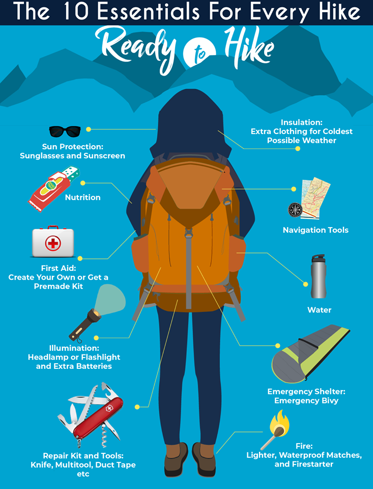
Take the essentials – Carry the ten essentials (see graphic below) in addition to any sport-specific equipment you might need. Carry more than you think you need, in case plans go south and you are caught out later than planned or even overnight. Consider carrying a satellite communications device in case there is an emergency, especially if there is no cell phone coverage in the area.

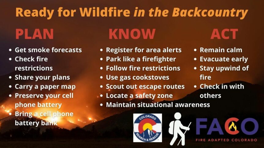
When thinking about the possibility of a wildfire, your trip planning process should include continuously checking https://inciweb.nwcg.gov/ and https://www.airnow.gov/ for current fire and smoke activity right up until the day of your departure. Have a plan B in case wildfire is near or the area is affected by smoke from fires elsewhere.
You should also map out escape routes from your destination in case the worst happens. If the trail you’re on is cut off, where will you go?
Register for emergency alerts in the county you will be in. Check county and local fire agency websites to find the right local alert system for that area. While you’re at it, check the local fire restrictions, and keep checking local weather forecasts.
Once you’re out
Once at the trailhead, park like a firefighter – in other words, back into a parking spot and make sure you can pull out quickly if you need to. Sign the trail register if there is one.
If you decide to deviate from your original plan for any reason, especially which trailhead you’ll be parking at, be sure to let your emergency contact know.
Conserve your cell phone battery, and if you’re carrying a PLB or satellite communication device, make sure it is fully charged before you leave.
As you hike, bike, or climb, be alert! Look for signs of smoke or fire.
Lastly, don’t become part of the problem. Do you really need a campfire? There are many reasons not to have one even if they are allowed:
- The majority of human-caused fires come from campfires
- Invasive species of insects can be transported on firewood
- Campfires can have negative impacts on ground cover and other vegetation in the area
- Burning trash in a campfire releases carcinogens and impacts wildlife
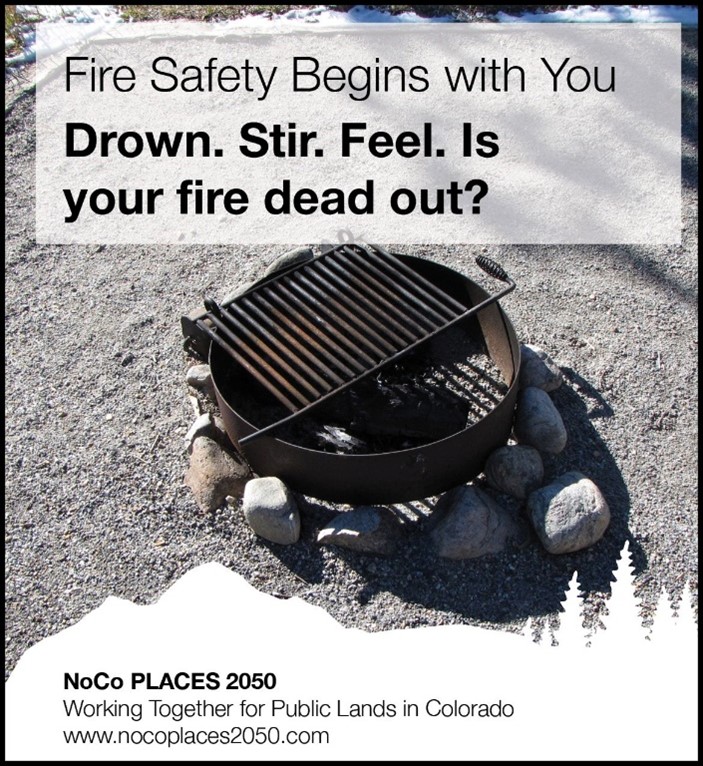
If you do decide to have a campfire, never leave it unattended. Use existing fire rings if possible or create your own and make it substantial. Keep the fire small and manageable and monitor the impact of winds. Avoid fires in areas with little wood, with fire scars, or at trailheads and parking lots. And put the fire out completely before you leave the area; douse it with water until it is cool to the touch.

If you see smoke or fire
If you encounter signs of a wildfire, call for help immediately. Stay away from densely vegetated areas. Keep an eye on the direction of the smoke and note whether it is light or dark; dark smoke means the fire is burning more intensely. Dial 911 if you have cell phone reception, and if you don’t, we hope you have a satellite communications device to message your emergency contact and tell them to dial 911. Once in contact with emergency responders, follow all instructions, just like the Ice Lake hikers did.
If the worst happens
Can you survive a wildfire in the backcountry if you’re caught in one? Here are some tips to increase your chances from Mark Rackay, Montrose County Sheriff’s Posse director and a newspaper columnist:
- If the fire is upon you, don’t try to outrun it. Find the best place you can to hunker down – an open spot away from vegetation, or a body of water or swampy area if possible.
- If you can find water at least a couple of feet deep, swim out into it and tread water.
- Sand bars or scree/boulder fields may be alternatives. Lie down and keep your face close to the ground. Find the coolest air you can to breathe and shield your clothing from flying sparks and embers. Keep your feet pointed toward the fire and shield your face as much as you can.
- Get rid of any synthetic clothing you may be wearing, which will melt at relatively low temperatures and severely burn you. However, if the only layer you have is synthetic, keep it on; it’s better than bare skin.
- Try not to panic. If you get up and run, the superheated air above you will injure you within seconds.
- Once the fire has passed, travel with caution. Burned trees can fall easily and debris on the ground will be white hot.
Experienced backcountry users have been using the term Know Before You Go for many years now, meaning you should do your homework before you venture out. Fire-related information and preparedness should be part of that homework.
Useful links:
- fs.usda.gov/visit/maps – Interactive visitor maps that can get you to national forest fire restrictions in a particular area
- smokybear.com – Wildfire history, prevention, education, and the benefits of fire
- fs.usda.gov/visit/forest-and-grasslands – State directory then linking to a forest directory, with current fire restrictions
- https://inciweb.nwcg.gov/ — National fire incident information system
- http://airnow.gov – National snapshot of current fires and smoke haze/air quality
- https://www.colorado.com/articles/colorado-wildfire-prevention-tips-resources – Wildfire prevention tips
- https://fireadaptedco.org/ — Fire Adapted Colorado, a non-profit organization working to build wildfire resilience capacity in wildfire-prone communities in Colorado.

