
By Cameron Torres, Chaffee County Search and Rescue South
GULCH: a deep or precipitous cleft. Especially: one occupied by a torrent
After I retired from the Air Force, I found my niche in our local search and rescue unit. I was a tad concerned when I showed up—dangling from cliffs, setting splints, and river rescues aren’t really in my wheelhouse. But I figured I’ve done enough trotting/hiking/walking over the last five years to be of use carrying all the crap that’s required for missions.
Turns out the number one asset I brought to the organization was not having a Monday through Friday job. Who knew?
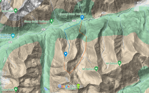
I used my packhorse skills last week on a mission over in Iowa Gulch, near the trailhead for the main routes to Mts Oxford, Belford, and Missouri. The map below shows what was happening. Day 1 of bighorn sheep (rifle) season. Three hunters took the Missouri Gulch trail up (see red line) above 13,000 feet and scoped out a herd. The next morning, they crested the ridge north of Missouri Mountain and bagged a sheep. The successful shooter had felt like ass all day and by the time they butchered their kill, he had puked forty times with blood spotting his vomit. They picked the first downhill stretch in the direction of their parked truck—Iowa Gulch (the marker between the red line and our SAR route blue line)—and called 911.
Three of us dispatched to the Missouri Gulch trailhead, planning to hike west to Iowa Gulch and then up to the hunters with oxygen in case the helicopter with our team doctor failed to find a suitable landing zone near the subjects. Over the next several hours, we watched the helo circle above, searching for both the hunters and a landing site. They spotted the subjects but couldn’t put the bird down. Eventually, the chopper landed on Missouri Ridge at about 13,ooo feet and our doc began hiking down the gulch.
We kept hiking up.
Our ground team left one member at about 10,300 feet to act as a visual and radio relay with our trailhead radio operator down on the road, while the other team member and I continued up the gulch. We rendezvoused with the subjects just above 11,000 feet at the same time our doctor caught up with them on his descent. It was dark. Doc evaluated the still-puking subject and gave him a choice: we spend the night on the mountain, then climb back up to the ridge in daylight for a helicopter extraction; or attempt a nighttime descent. Funny how no one in trouble relishes the thought of going back uphill. The subject chose the descent.
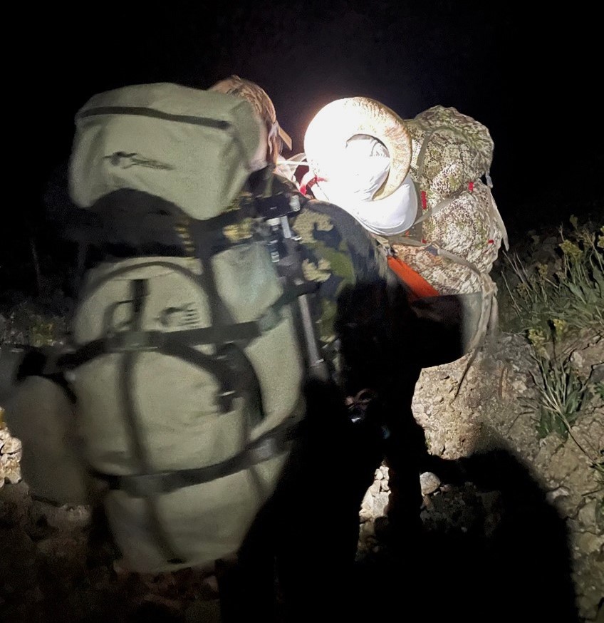
My toting talents continued to be of use. After hooking our patient up to the oxygen, I carried the bottle and tubes and tucked in close behind the subject for the four-hour descent. Of course, the alternative was to help the subject’s fellow hunters pack out 150lbs of sheep meat…baaaaa-d idea.
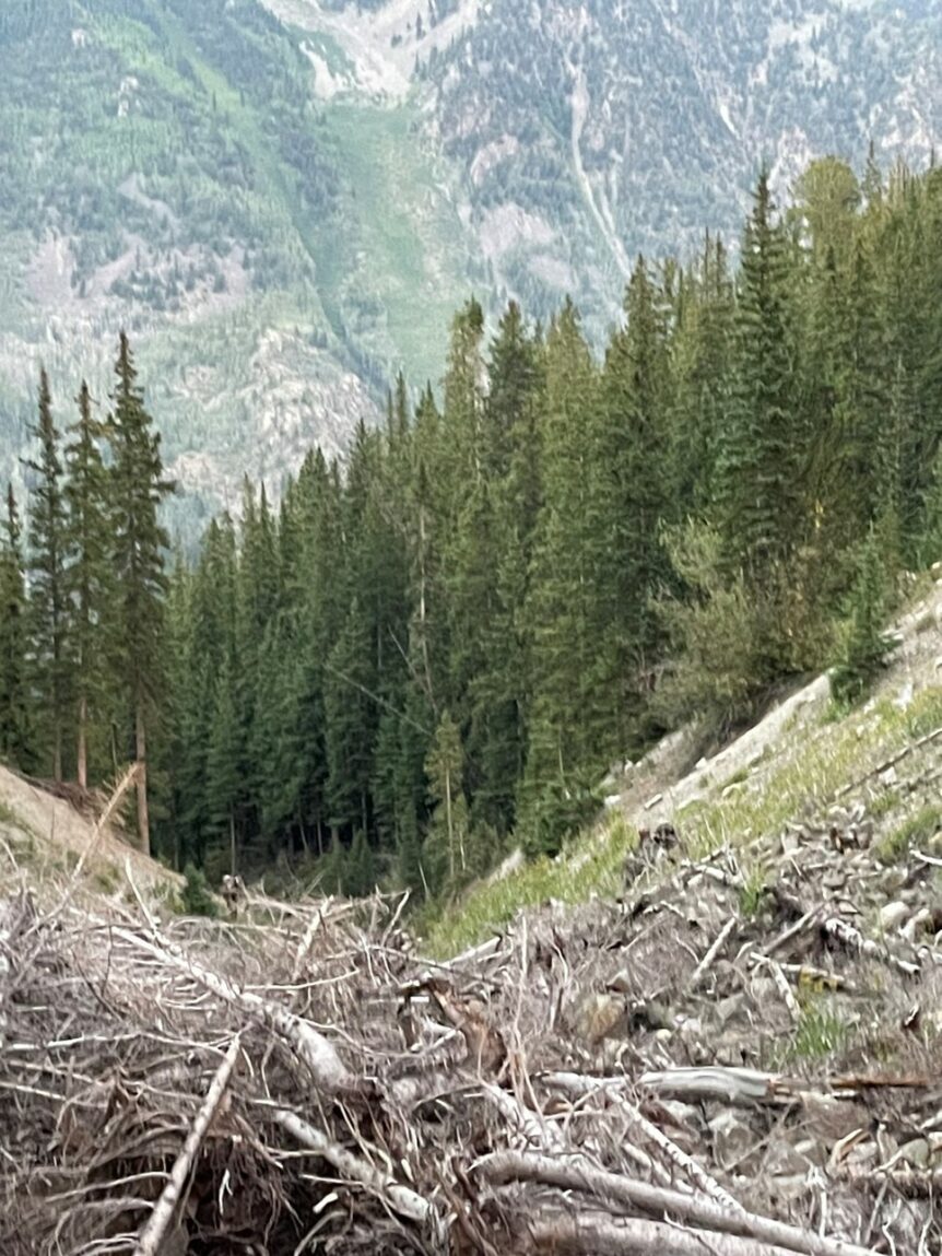
It was slow. Traction was an issue. Just when we thought we were out of the rocky gulch and had nothing but forest and a river in front of us, one hunter tripped over a bee’s nest. That took a while to straighten out and left a few welts. We forded a knee-high river around midnight and climbed up to the road and the ambulance, where the EMTs treated our sick subject and admired our bee stings.
Decent story with a good ending. No serious injuries. What the subjects didn’t realize is that in the Rockies, if your map doesn’t show a trail near the gulch you are considering, you shouldn’t use it for a climb or descent. Many of the gulches end in cliffs with impassable waterfalls. These hunters got lucky, and the safer alternative would have been the shorter climb back to the established trail.