
By Charles Pitman, Summit County Rescue Group
Being lost in the wilderness is a frightening experience. Whether you are 100 feet or a half mile off the trail, you don’t see how anyone could possibly find you. Yet, there are some inexpensive ways to improve your situation and help relocate your intended route, besides calling for search and rescue (SAR).
In 2021, Summit County Rescue Group (SCRG) fielded a record number of calls for assistance. Of the 215 SAR calls placed to Summit County’s 911 call center, a large number were from people who had simply lost the trail. There are several common situations we encounter, some of which can be mitigated by good planning, carrying the right gear, paying better attention during your hike, and avoiding a few common mistakes.
Losing the trail at night is often the result of a hike taking longer than anticipated. Altitude alone can increase a hiker’s fatigue. The four-hour hike may take six or eight hours. Your intended departure time wasn’t really at 9:00 a.m. as planned, but rather at 1:00 p.m. Did you adjust your destination to account for the later start? Was the hike longer to see more scenery?
When night falls, trails will easily disappear unless you have a good headlamp. You may have a cell phone with a light, but if that phone has been on all day is the battery nearly drained? The easy solution is to always have a headlamp with spare batteries. New LED lights are powerful, long lasting and inexpensive. They also free up your hands to grab onto handholds on tougher sections of a trail or put in your pockets to keep warm. I have three headlamps in my pack, my main one, one backup, and one to loan to the lost hiker we have found. I also have a small but powerful LED flashlight, the ‘backup to the backup.’
Often a hiker becomes lost by wandering off the trail, perhaps following a ‘social trail’ or a thin game trail that has disappeared, perhaps to get a better view. Then they realize they have entirely lost the main hiking route.
One summer we responded to a mother and three children who decided to follow a deer, only to find, after 30 minutes of wandering, they had absolutely no idea where the trail was located. Panic set in and the feeling of hopelessness for this woman was palpable. When a person has been lost for hours they can have a sense of impending doom. After all, how could a search and rescue team possibly find you in the middle of a huge forest? The lost party was ecstatic when we did find them.
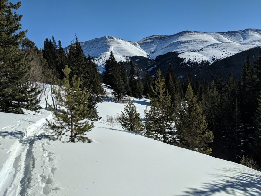
During winter months, the trail that was obvious during your ascent may become completely obscured by the previous hour’s snowstorm or by a significant wind event. Winds on some mountains can easily top 50 to 80 mph or more, covering a trail in minutes.
Your main focus should be to try to keep a really good sense of your hike in — have you passed social trails? Are you on a ridge line? What streams have you crossed? Have you passed US Forest Service Wilderness and trail signs? Do you know exactly what trail you are on? It is not uncommon for a lost party to say they are on one named trail only for a SAR team to find them on a trail in a completely different direction. I once met a man hiking above tree line and heading up a steep climb, asking how much farther to Willow Creek Falls. But there was no water, especially significant running water, anywhere around. He had completely blown past a prominent four-way junction with signs clearly marking the trail he was looking for.
GPS phone apps, inexpensive and easy to use with some practice, can provide all the information you need to relocate a safe route back out. When we receive distress calls from a lost hiker or skier we are generally given GPS coordinates 911 dispatchers automatically obtain from their phone. Sitting at our dining room table with a laptop, we can plot the coordinates and tell the distressed hiker which way to travel to relocate the trail. We can also view the location on both a traditional map with contour lines and a Google Earth view, so we can direct someone around a major rock band, boulder field or swampy area and toward an easier hiking route. This is something every backcountry user can learn to do on their phone.
Using GPS apps does not generally require mobile phone connectivity. You simply pre-download the maps for the area in which you are hiking and you can immediately hike with more confidence! However, we do highly encourage hikers to place their phone in airplane mode to conserve battery life while in the backcountry. Some GPS apps can also be used to find trails and hikes all over the world.
What is the best GPS app on the market? It’s the one you know how to use. Download one and play around with it while walking in your neighborhood. There are several to check out, including Backcountry Navigator, AllTrails, CAL TOPO, Motion X, and GAIA GPS, and others. Check the reviews and find one that suits your needs and abilities.
I recently responded to two almost identical calls, within a three-day period, for parties on the same 14,250 foot peak. In both cases, the parties were novice hikers from out of state and not acclimated to the altitude. It was after dark and the weather was terrible, with cold temperatures, falling and deep snow, and high winds. One call was from the panicked lost party himself, and the other call was from worried friends of a hiker who was very overdue. These had two different resolutions.
In the first case, the lost party was at an altitude where he still had cell phone reception and he plotted far off the trail in hip-deep snow. I was able to talk him back to the trail and met him when he exited the field, very cold and tired after a nine-hour hike. In the second case, the hiker was fine but his hike had simply taken longer than expected and he had no cell phone service to notify his friends. However, this man also had a good GPS app that kept him on the trail and out of danger, even though it was well after dark and the weather was poor.
Both had good outcomes. But one man was seriously panicked and in a bad mental state, and the other was completely calm because he knew exactly where he was throughout his hike. Staying calm and avoiding panic can help you to make better decisions, regardless of your situation.
SAR teams in Colorado are typically available to help locate and bring out a lost hiker, often 24 hours a day in all weather conditions. But being able to know your own position at all times and prevent that 911 call in the first place can give you a wonderful peace of mind.